
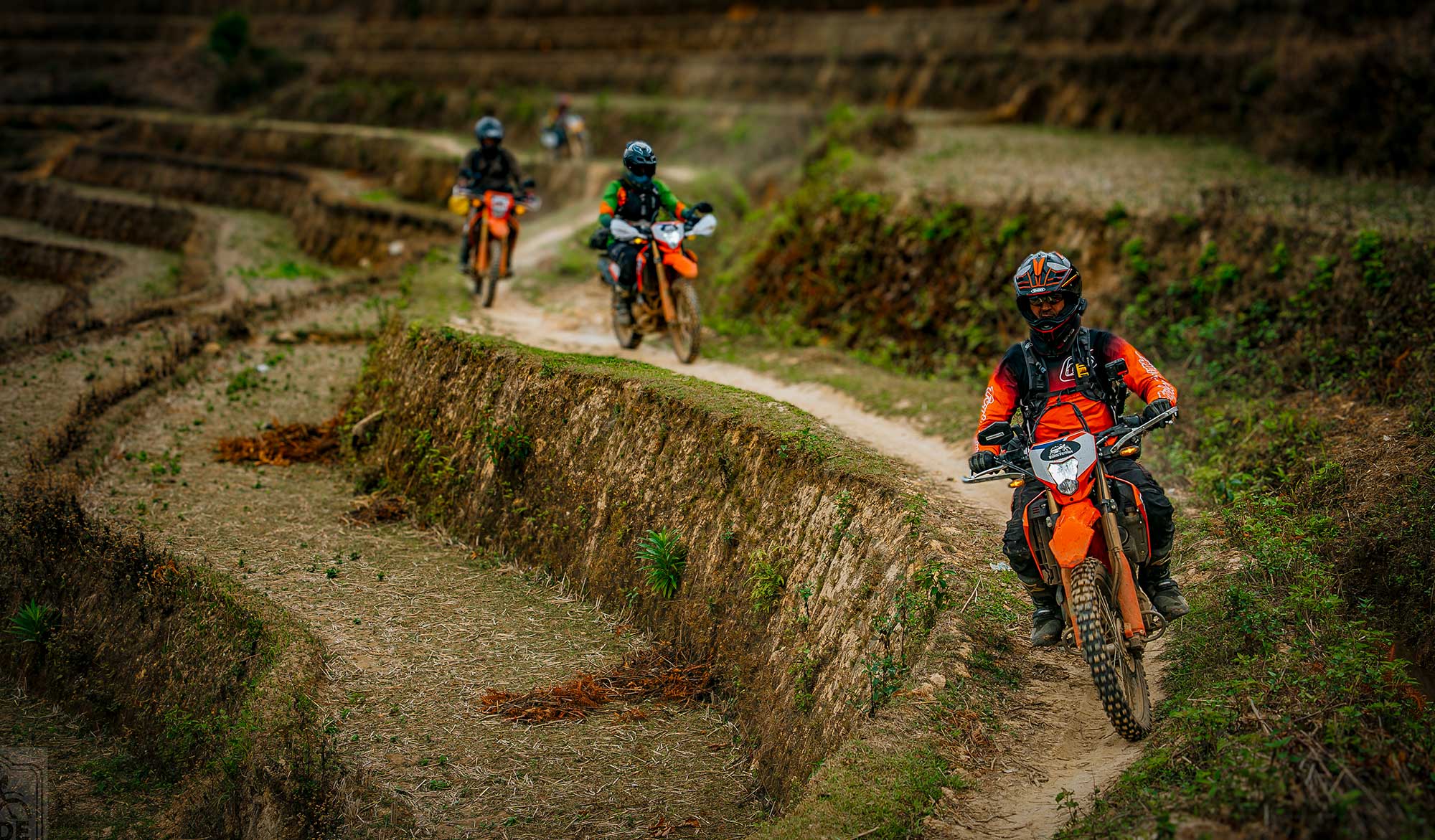
Vietnam Motorbike Tour Planning Guide
Best Time for Northern Vietnam Motorbike Tours: Ha Giang vs Northwest Weather and Seasons
Ha Giang and Northwest Vietnam may appear close together on a map, but they do not always share the same weather. Mountain barriers, altitude, cold air arriving from China and seasonal winds crossing Laos can create very different riding conditions on the same day.
The quick answer
October and November offer one of the best overall combinations for Northern Vietnam motorbike tours: cooler air, reduced humidity, improving visibility and a lower probability of prolonged heavy rain. March and April are also excellent for spring landscapes and comfortable riding, although cloud, drizzle and local mountain showers remain possible.
For the Ho Chi Minh Trail through Phong Nha, Khe Sanh, Hue and Hoi An, the strongest general window is usually February to April. The central region has a later and more concentrated wet season than the northern mountains, particularly around September, October and November.
Why Northern Vietnam weather changes so much between regions
Northern Vietnam sits where several major influences meet: the Asian continental landmass to the north, the Gulf of Tonkin and East Sea to the east, the mountains of Laos to the west, and some of Southeast Asia’s highest terrain running through the centre of the north. Weather is therefore controlled by more than the simple labels “dry season” and “rainy season”.
In winter, northeast monsoon flow and periodic cold surges move south from continental China. The air may arrive cold and comparatively dry, but it can collect moisture while crossing the Gulf of Tonkin. When that air reaches the mountains, it produces low cloud, fog, drizzle and a sharp drop in temperature. This effect is often strongest in exposed northeastern districts close to the Chinese border.
In summer, warm and humid monsoon circulation feeds thunderstorms and heavy rain across the north. Tropical depressions and typhoons can add several days of intense rainfall. Mountains force air upward, strengthening rain on windward slopes while creating drier and hotter conditions on some leeward slopes.
This is why a forecast for Hanoi cannot accurately describe conditions on Ma Pi Leng Pass, in Sa Pa, at Mu Cang Chai or beside the Black River. A motorbike journey can climb more than 1,000 metres in a few hours and pass from sunshine into cloud, cold wind or a local thunderstorm.
Ha Giang vs Northwest Vietnam: what is the real difference?
| Factor | Ha Giang and the Northeast | Northwest Vietnam |
|---|---|---|
| Main geographic exposure | Open to continental air and cold surges moving south from China. | Partly shielded by the Hoang Lien Son range, with complex valleys and leeward slopes toward Laos. |
| Typical winter character | Cold, grey, windy and sometimes damp, especially around Quan Ba, Yen Minh, Dong Van and Meo Vac. | Very cold at high altitude around Sa Pa and Fansipan, but some western valleys can be brighter and drier. |
| Summer character | Hot and humid at lower elevations; frequent mountain showers, thunderstorms and landslide risk. | Wet in many mountain areas, but hot dry spells can occur when southwesterly air descends from Laos. |
| Landscape | Limestone plateau, deep canyons, exposed passes, narrow valleys and border mountains. | Higher massifs, terraced valleys, forests, broad river systems and long mountain passes. |
| Road-weather risk | Fog, wet polished limestone roads, rockfall, sharp temperature changes and exposed crosswinds. | Fog at high passes, mud on off-road sections, flash flooding, landslides and heat in lower western valleys. |
| Strongest general riding periods | March–April and October–November. | March–May and late September–November, depending on rice season and route altitude. |
Ha Giang: colder continental influence and exposed limestone passes
Ha Giang lies directly against the Chinese border. The famous riding areas of Quan Ba, Yen Minh, Dong Van and Meo Vac are positioned on high limestone terrain with exposed passes and deep valleys. When a cold surge moves south from China, the temperature can fall quickly. Cloud may wrap around the mountains, and visibility on the passes can reduce from panoramic to only a short distance.
The rock plateau can also feel colder than a thermometer suggests because of wind exposure. In damp winter conditions, riders lose heat quickly through wet gloves, boots and clothing. The reward is a dramatic mountain atmosphere, fewer visitors and exceptionally clear views when dry continental air arrives behind a cold front.
Explore the route options on our Ha Giang motorbike tours page.
Northwest Vietnam: higher mountains, rain shadows and stronger local contrasts
Northwest Vietnam includes areas such as Mai Chau, Moc Chau, Son La, Dien Bien, Mu Cang Chai, Lai Chau and Sa Pa. It is dominated by the Hoang Lien Son range and a maze of high ridges, river valleys and plateaux. The result is extreme local variation.
Sa Pa may be cold and hidden in cloud while lower valleys toward Son La or Dien Bien remain warmer and brighter. A pass can receive heavy rain on one side and much drier air on the other. The mountains weaken some winter northeast airflow, so parts of the Northwest may experience fewer damp, grey days than Ha Giang. However, altitude can still make Sa Pa and the highest passes colder than the Northeast.
See our guided Northwest Vietnam motorbike tours for routes through remote valleys, terraced rice country and high mountain passes.
How cold air from China changes Ha Giang and Northern Vietnam
From roughly late autumn through early spring, strong high-pressure systems can develop over continental Asia. Pulses of colder air move south through China into northern Vietnam. Vietnamese forecasts commonly describe these events as cold surges or strengthened northeast monsoon conditions.
For motorbike riders, the practical effects can include:
- A rapid temperature drop, sometimes within a few hours.
- Stronger northeast winds on open ridges and passes.
- Low cloud and reduced visibility where moist air is lifted over mountains.
- Fine drizzle that keeps roads wet even without heavy rain.
- Much lower apparent temperature when wind chill and wet clothing are combined.
Ha Giang is especially sensitive because its northern plateau faces the incoming air. Cao Bang and Lang Son can show similar patterns. In the Northwest, the Hoang Lien Son mountains act as a major barrier, reducing or redirecting the airflow. This does not make the Northwest warm: high-altitude Sa Pa remains cold, but the regional pattern is less uniform.
How winds from Laos affect temperature and precipitation
During the warmer part of the year, southwesterly monsoon flow crosses mainland Southeast Asia. This air can bring rain to western mountain slopes. However, when it is forced over the Annamite Range and other high terrain, it may lose moisture on the windward side and descend into Vietnam as a hotter and drier wind.
This downslope warming is often associated with the hot, dry “Lao wind” or gió Lào, particularly in North Central Vietnam. The effect is most famous in provinces along and near the Ho Chi Minh Trail, including Nghe An, Ha Tinh, Quang Binh and Quang Tri, but hot southwesterly episodes can also influence western northern valleys.
The same broad airflow therefore creates opposite outcomes depending on terrain:
- Rising air: cooling, cloud development and increased rainfall.
- Descending air: warming, lower humidity and reduced rainfall.
In Northwest Vietnam, this helps explain why Son La or Dien Bien can sometimes become much hotter than high, cloudy Sa Pa. It also explains why the Ho Chi Minh Trail can be extremely hot and dry in late spring and summer even while other parts of Vietnam are in a wet monsoon period.
Altitude: why Sa Pa and Ha Giang feel colder than Hanoi
Air temperature generally decreases as elevation increases. The exact rate changes with humidity and atmospheric conditions, but a useful planning principle is that a climb of 1,000 metres can produce a substantial temperature reduction. Mountains also force air upward, encouraging cloud and precipitation, while valleys can trap fog or cold air overnight.
Sa Pa altitude and weather
Sa Pa sits at approximately 1,500 to 1,800 metres above sea level, according to Vietnam Airlines’ destination guide. Fansipan rises to 3,143 metres. At this elevation, Sa Pa can be 8–12°C cooler than lower northern cities during certain weather patterns. Cloud can form rapidly, and the combination of mist, wind and dampness often makes conditions feel colder than the reported temperature.
Winter frost and occasional snow are possible in the highest areas. In summer, Sa Pa is usually cooler than the lowlands, but heavy rain, thunderstorms and landslides remain important hazards.
Ha Giang and Dong Van plateau altitude
Ha Giang City is relatively low, but the motorbike loop climbs into high terrain. Vietnam’s tourism authority describes the Dong Van Karst Plateau as averaging approximately 1,400 to 1,600 metres. Dong Van town is around 1,025 metres, while Ma Pi Leng Pass reaches roughly 1,500 metres.
This elevation produces large changes during a normal riding day. Riders may leave a mild valley, climb into cold fog, descend into warmer air and then return to another exposed pass before evening. Packing only for the starting temperature is one of the most common mistakes on a Ha Giang motorbike tour.
Month-by-month weather comparison for Vietnam motorbike tours
The table below is a planning guide, not a forecast. Mountain weather is variable, and tropical storms can disrupt normal seasonal patterns. Always check current warnings before departure.
| Month | Ha Giang | Northwest Vietnam | Ho Chi Minh Trail | Overall riding assessment |
|---|---|---|---|---|
| January | Cold, exposed and often cloudy; fog or drizzle possible. | Cold at altitude; Sa Pa may have frost or rare snow. Some western valleys are drier. | Improving in the central region, but residual rain can continue early in the month. | Good with winter gear |
| February | Cool to cold; mist and spring drizzle possible. | Cool, variable and often atmospheric; drier spells become more frequent. | One of the best months: mild temperatures and generally lower rainfall. | Very good |
| March | Comfortable temperatures; cloud and light rain remain possible. | Excellent spring riding, with flowers, clearer periods and moderate temperatures. | Excellent: warm, generally dry and not yet at peak summer heat. | Excellent |
| April | Warmer, greener and increasingly humid; thunderstorms begin to develop. | Strong riding month; warmer valleys, cool high passes and spring scenery. | Excellent to very good; heat increases late in the month. | Excellent |
| May | Hotter and wetter; intense afternoon showers become more common. | Green landscapes and water-filled rice terraces; rain and heat increase. | Hot and sometimes very dry under southwesterly winds. | Good, weather dependent |
| June | Wet season; thunderstorms, landslides and slippery roads. | Warm to hot, humid and wet; excellent green scenery but greater route risk. | Very hot; dry wind episodes possible, with local storms. | Challenging |
| July | Among the wettest periods; flash floods and landslides possible. | Heavy rain risk, muddy tracks and reduced visibility at high passes. | Hot and humid; storm risk increases, especially near the coast. | Challenging |
| August | Wet, humid and storm affected; road disruptions possible. | Wet but spectacularly green; rice terraces develop toward harvest. | Hot with increasing tropical storm risk. | Variable |
| September | Rain begins to ease later in the month; rice landscapes can be excellent. | Golden rice season in some highland areas; still some heavy showers. | Central wet season intensifies; storms and flooding become a major concern. | North good; trail poor |
| October | Cooler, generally drier and often clear: one of the best months. | Excellent temperatures and visibility; harvest landscapes early in the month. | High risk of heavy central rain, typhoons and flooding. | North excellent; trail avoid |
| November | Cool, drier and clear between cold fronts; strong riding conditions. | Drying, cooler and often sunny; cold nights at altitude. | Heavy rain can continue in Hue and Hoi An; conditions improve north of the main rain belt. | North excellent; trail variable |
| December | Dry but increasingly cold; fog and cold surges possible. | Cold at altitude, often dry in western valleys; winter equipment required. | Rain gradually decreases, but central sections can remain unsettled. | Good with flexibility |
Best time for a Ha Giang motorbike tour
March to April and October to November are the strongest general choices. Spring brings flowers, green valleys and comfortable temperatures. Autumn usually brings lower humidity, improving road surfaces and clearer mountain views.
December to February can be rewarding for riders prepared for cold weather, but fog, drizzle and strong cold surges may reduce visibility. June to August offers dramatic green scenery, but the likelihood of heavy rain, rockfall, landslides and road closures is much higher.
Best time for a Northwest Vietnam motorbike tour
March to May is excellent for spring weather, mountain flowers and water-filled rice terraces. Late September through November brings harvest colours, clearer air and cooler riding temperatures.
The Northwest can still be rewarding in summer, particularly for experienced off-road riders seeking green scenery. However, itineraries must remain flexible because local rain can transform dirt tracks, river crossings and mountain roads within hours.
Sa Pa and the highest passes require warm and waterproof layers in every season. Even in July, a wet descent through cloud can feel cold after several hours on the bike.
Northern Vietnam vs the Ho Chi Minh Trail: different weather calendars
The Ho Chi Minh Trail route crosses a long north–south corridor through areas such as Phong Nha, Khe Sanh, the former DMZ, Hue, Hai Van Pass and Hoi An. This corridor is affected by the Annamite Range, the East Sea, tropical storms and the hot southwesterly wind crossing Laos.
Unlike Ha Giang and Northwest Vietnam, where the main rainy season is broadly concentrated in summer, the central coast often receives its heaviest rain later in the year. Moist northeast winds, tropical cyclones and terrain lifting can produce extreme rainfall from approximately September into November. Hue and Hoi An are particularly vulnerable to flooding during strong events.
| Question | Northern mountains | Ho Chi Minh Trail and Central Vietnam |
|---|---|---|
| Best broad window | March–April and October–November. | February–April. |
| Main wet-season concern | Summer monsoon rain, thunderstorms, flash floods and landslides from May–September. | Late-year heavy rain, typhoons and flooding, especially September–November. |
| Main heat concern | Hot lower valleys in May–August; high areas remain cooler. | Severe heat and dry southwesterly winds in May–August. |
| Main cold concern | Cold surges from China and altitude from December–February. | Cool and damp periods in northern trail sections, but generally less severe than the high north. |
| Most difficult months | July and August for heavy rain. | October and November for central flooding and storms. |
For an expedition linking historic battlefields, jungle roads and the central coast, view our Ho Chi Minh Trail motorbike tours.
Practical weather planning for a Vietnam motorbike tour
1. Plan by region, not by country
Vietnam is long and topographically complex. A national weather summary is too broad for route planning. Check the forecast separately for Ha Giang, Dong Van, Sa Pa, Son La, Phong Nha, Khe Sanh, Hue and Hoi An.
2. Use altitude-adjusted clothing
Carry a waterproof outer layer, insulating mid-layer and dry gloves even when Hanoi is warm. Mountain weather changes rapidly, and long exposure on a motorcycle increases heat loss.
3. Treat rain intensity as more important than rain probability
A forecast showing “rain” may mean a short afternoon shower or a prolonged tropical downpour. The second creates serious risks: reduced braking grip, falling rocks, flash floods, deep mud and landslides.
4. Check the previous three days of rainfall
Roads may remain unstable after the sky clears. Saturated slopes can fail later, and unsealed tracks may take days to dry. Recent rainfall is especially important for remote off-road sections.
5. Build flexibility into the itinerary
A professionally guided tour can change roads, departure times or overnight stops when weather deteriorates. That flexibility is often more valuable than trying to follow a fixed digital route in remote mountain terrain.
6. Do not ride exposed passes in dense fog after dark
Visibility, temperature and road grip all deteriorate. Livestock, trucks, broken surfaces and unmarked roadworks are harder to detect. Mountain days should be planned to finish before sunset.
Choose the right Vietnam motorbike tour for the season
Our routes are designed around local geography, realistic riding distances and seasonal road conditions. Compare these regional tour collections:
- Ha Giang Motorbike Tours — limestone plateaux, border roads, Ma Pi Leng Pass and remote ethnic minority villages.
- Northwest Vietnam Motorbike Tours — Sa Pa, Mu Cang Chai, Son La, terraced valleys and high mountain passes.
- Ho Chi Minh Trail Motorbike Tours — Phong Nha, Khe Sanh, the DMZ, Hue, Hai Van Pass and Hoi An.
- All Vietnam Motorbike Tours — compare our complete range of guided adventures.
- Vietnam Motorbike Travel Blog — route reports, riding advice and destination guides.
Authoritative weather, climate and travel sources
These external links help riders verify current conditions and understand the regional climate. External sources should support—not replace—local route assessment on the day of travel.
- Vietnam National Center for Hydro-Meteorological Forecasting — official forecasts, cold-surge information, tropical cyclone alerts and seasonal outlooks.
- Vietnam National Weather Service – Vietnamese site — radar, satellite images, rainfall maps and warnings.
- Vietnam National Authority of Tourism weather guide — official overview of seasonal differences across Vietnam.
- Official Vietnam Tourism guide to Sa Pa — destination and mountain information.
- Vietnam tourism information on Ha Giang and Dong Van — regional altitude and tourism background.
- Windy weather maps — visual forecast layers for rain, cloud, wind and temperature. Compare more than one forecast model.
- Zoom Earth — satellite, rainfall and tropical storm tracking.
- Weather Underground — local forecasts and available station observations.
- Google Maps — useful for location reference, but never rely on estimated travel time alone for remote mountain roads.
Editorial methodology and experience
This guide combines regional motorbike-tour planning principles with information from Vietnam’s official forecasting service, the Vietnam National Authority of Tourism, published destination altitude data and established monsoon climatology. Seasonal windows are broad planning ranges rather than guarantees.
Before publication, add a short named author profile with direct experience riding or guiding in Ha Giang, Northwest Vietnam and the Ho Chi Minh Trail. Include the author’s role, years of experience, a photograph and links to relevant ride reports. First-hand evidence—original photographs, route observations and dated field notes—will strengthen reader trust and the page’s value to search engines and AI answer systems.
Frequently asked questions
What is the best month for a Northern Vietnam motorbike tour?
October and November are among the most dependable months across Ha Giang and Northwest Vietnam. March and April are also excellent, particularly for spring scenery and moderate temperatures.
Is Ha Giang colder than Northwest Vietnam?
Ha Giang is often more directly exposed to cold air from China. However, high Northwest locations such as Sa Pa can be equally cold or colder because they sit at greater altitude. Weather varies substantially between valleys and passes.
When is the rainy season in Ha Giang?
The principal wet period is generally May to September, with June, July and August carrying a higher risk of intense rain, landslides and flash flooding.
When is the rainy season in Northwest Vietnam?
The Northwest also receives most of its rain from May to September. Mountain orientation produces strong local variation, so Sa Pa, Son La, Dien Bien and Mu Cang Chai may have different conditions on the same day.
What is the best time to ride the Ho Chi Minh Trail?
February to April is usually the strongest all-round period, offering lower rainfall, pleasant temperatures and better road conditions through much of the central route.
Should I avoid Central Vietnam in October?
October often carries a high risk of heavy rain, typhoons and flooding around Hue, Da Nang and Hoi An. A tour may still operate during dry intervals, but fixed plans require significant caution and flexibility.
Can I ride Ha Giang in winter?
Yes, but prepare for cold wind, fog, drizzle and reduced visibility. Proper waterproof riding equipment and flexible daily distances are essential.
Why can Sa Pa be cold in summer?
Sa Pa is approximately 1,500 to 1,800 metres above sea level. Altitude lowers temperature, while cloud, rain and wind increase heat loss. A wet summer day can therefore feel surprisingly cold on a motorcycle.